Forests are vital ecosystems that help store carbon, regulate water cycles, provide habitat for wildlife, and protect soil. To keep them healthy, people have long monitored forest health in many ways. Recently, aerial drones (also called UAVs — unmanned aerial vehicles) have begun to change how we do that monitoring. In this article, I will describe past methods of forest monitoring; show how drones are revolutionizing forestry; explore the technologies used with drones (such as LiDAR, thermal and multispectral sensors); discuss places where the technology is most useful; list the major stakeholders; examine what exactly can be monitored; and see how forest animals can benefit from this technology.
What methods have people used to monitor forests in the past?
Traditionally, forest monitoring has relied on ground-based surveys, aerial photography, and satellite remote sensing. Ground surveys involve foresters walking through forests to count trees, measure diameter, check the forest health (for example, look for disease or pests), and collect samples. Aerial photography, which is photography from planes or helicopters, has provided overhead views, enabling sketching or mapping of boundaries, forest cover change, and damage. Satellite imagery, for example from NASA’s Landsat program, has allowed monitoring large areas, tracking changes in forest cover over time and detecting deforestation, wildfires, or disease spread. Satellite imagery, however, often has limitations in the resolution of images, and in detecting fine-scale damage.
How have drones revolutionized forestry?
Drones bring a leap forward because they combine flexibility, resolution, cost-effectiveness, and speed. Unlike satellites, drones can fly closer to the forest, producing high-resolution images and even three-dimensional mapping. Because drones are smaller and more mobile, they can be deployed more frequently, and respond quickly to events such as fires or pest outbreaks. For example, in Washington State, forestry companies use drones to count trees, map harvest areas, monitor damage after fire, detect invasive species, and 3-D image forest structure. As another example of drone technology, small lightweight drones have been used in Borneo to measure forest carbon with accuracy comparable to field measurements, much more cheaply and quickly than traditional methods.
What kinds of technology have been implemented with drones to improve our efforts?
Several technological tools are now used with drones to improve forest monitoring:
LiDAR, Light Detection and Ranging, emits laser pulses to measure distance. This allows building detailed 3D models of forest canopy and ground, as well as estimating tree height, biomass, canopy gaps, and density.
Photogrammetry / structure-from-motion, uses overlapping photographs (usually high-resolution RGB cameras) from many angles to build 3D point clouds and canopy height models. The Borneo drone-carbon project is an example.
Multispectral / hyperspectral sensors have cameras that detect not just red, green, blue, but Near-Infrared, red-edge and other bands. These allow measurement of vegetation health (chlorophyll content, stress, disease) before visible symptoms appear.
Thermal imaging has infrared sensors to detect heat; useful for detecting fires (hotspots), detecting animal bodies (in rescue or counting), or even detecting areas of tree stress (e.g. water stress) because they might be warmer or cooler than healthy surroundings.
Autonomous/robotic flight and sensors deployment allows for under-canopy drones that fly inside forests (where GPS may not work well) to map interior, avoid obstacles; drones that can shoot or attach sensors to trees to monitor changes over time; machine learning algorithms to automate identification (species, damage) and anomaly detection.
Where would this technology be most beneficial?
While drone-based monitoring can help almost anywhere, there are some regions and situations where it is especially advantageous:
Remote forests and difficult terrain: Areas that are hard to access on foot or by vehicle benefit because drones can fly above or into such areas.
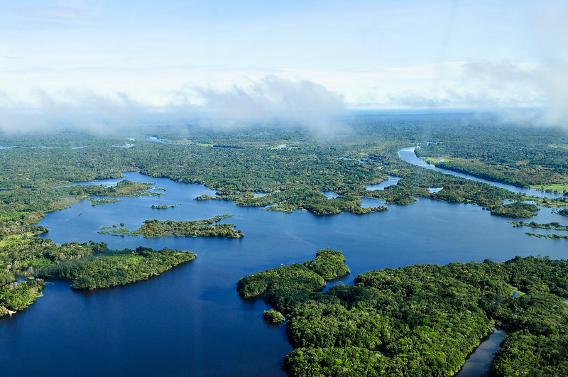
Tropical forests: High biodiversity, rapid change, clouds often obstruct satellites; under-canopy structure is complex, so high resolution is needed.
Post-disaster zones: After fires, storms, pest outbreaks; being able to quickly assess damage, map areas needing replanting.
Community forests / restoration projects: Smaller scale, local stakeholders who need frequent, cheaper monitoring, often with limited resources.
Regions with high conservation pressure: Places where forests are threatened, and fast detection of illegal activities matters. For example Amazon indigenous communities using drones to catch early deforestation.
Who (major stakeholders) would be interested in using these drones to keep forests healthy?
There are many groups with interest in forest health who would benefit:
Government forestry and environmental agencies: National, state, or provincial governments responsible for forest management, fire control, wildlife protection.
Indigenous communities / local forest-dependent people: They often have rights or interests in maintaining forest, and need tools to monitor what’s happening. For example, in Panama indigenous communities trained to use drones for monitoring deforestation and land use change.
Non-governmental organizations (NGOs) and conservation groups: To monitor biodiversity, illegal logging, restoration success, and for advocacy.
Academic / research institutions: To pioneer methods, understand ecosystems, study wildlife populations, climate change impacts, etc.
Private sector / forest industry: Timber companies, reforestation service providers; companies with sustainability or carbon-offset goals; companies that need monitoring to satisfy regulations or consumers.
Climate and carbon finance / ecosystem services programs: Programs such as REDD+ (Reducing Emissions from Deforestation and Forest Degradation) need measurements of carbon stocks and changes over time, which drones can help with.
What exactly are the types of things that this technology can monitor, and how does it help forest animals?
Drones can monitor a wide variety of forest health indicators:
Forest cover change / deforestation / land use change: Detecting when trees are cut, cleared, or converted to other uses.
Tree health, disease, pest infestations: Early signs of stress in foliage, detecting bark beetles or fungal diseases.
Biomass and carbon storage: Estimating how much carbon is stored in trees, how that changes over time. This matters for climate change mitigation.
Canopy structure and growth: Tree height, canopy gaps, density, regeneration of young trees.
Fire detection and monitoring: Detecting heat-signatures early, mapping burnt areas, guiding firefighting efforts.
Illegal logging or human activity: Patrols for unauthorized cutting, land grabbing, encroachment.
Wildlife monitoring: Counting animals by detecting heat or movement; tracking migration patterns or habitat use; less disturbance because drone flights can be less invasive than human presence.
Environmental variables: Temperature, humidity, light; sometimes soil moisture; in some cases air pollution or water quality if water bodies are included.
For forest animals, this technology helps by: detecting habitat degradation early; ensuring important corridors are preserved; reacting more rapidly to threats (fires, poaching); enabling non-disruptive observation of wildlife, which means less stress; aiding in restoration efforts so that habitat is restored more efficiently, which supports animal populations.
In summary, forest monitoring has evolved from ground surveys and aerial photos to satellite remote sensing, and now increasingly to drone-based technologies. Drones bring high resolution, flexibility, speed, and cost reduction, especially when combined with advanced sensors (LiDAR, multispectral, thermal) and machine learning. They are especially valuable in remote, tropical, or high-risk areas, and they serve many stakeholders: governments, indigenous groups, NGOs, private companies, and researchers. The kinds of data drones can gather are wide ranging—from canopy structure, carbon storage, fires, to wildlife behavior—and this data can help not only in tracking threats but also supporting forest animals and conserving biodiversity. As drone technology and related software continue to improve, we are likely to see more accurate, widespread, and equitable forest monitoring—something critical for continued health of forests and for the planet.
Works Cited
American Bar Association. (n.d.). Much abuzz about drones: Drones and forest management. https://www.americanbar.org/groups/environment_energy_resources/resources/newsletters/forest-resources/much-abuzz-about-drones-drones-forest-management/
Forestry.com. (2024, September 4). How Drones Are Safeguarding Nature and Safety in Forestry. https://forestry.com/environmental-impact/conservation-initiatives/how-drones-are-safeguarding-nature-and-safety-in-forestry/
Forestry.com. (n.d.). How Drones Are Used for Forestry Management. https://forestry.com/education-and-community/educational-resources/how-drones-are-used-for-forestry-management/
How Drones are Revolutionizing Forestry. (n.d.). Purdue University Institute for Digital Forestry. https://ag.purdue.edu/digital-forestry/projects/tree-inventory-with-aerial-remote-sensing.html
MDPI. (n.d.). Small Drones for Community-Based Forest Monitoring: An Assessment of Their Feasibility and Potential in Tropical Areas. https://www.mdpi.com/1999-4907/5/6/1481
University of Bristol. (2025, May 7). Pioneering research reveals tree-mendous potential of inexpensive drones to help community forests flourish. https://www.sciencedaily.com/releases/2025/05/250507130344.htm
Washington Forest Protection Association. (n.d.). Drones provide foresters a new perspective. https://www.wfpa.org/news-resources/blog/drones-provide-foresters-a-new-perspective/
U.S. Geological Survey. (2022). Fifty years of Landsat: Observing global forests from above the canopy. https://www.usgs.gov/news/featured-story/fifty-years-landsat-observing-global-forests-above-canopy